Effortlessly manage your KML/KMZ/GPX files with MAPinr, a powerful GIS tool that also offers measuring capabilities, GPS logging, WMS support, and offline maps. Designed for ease of use, MAPinr helps you navigate the fast-paced world of Android updates while keeping your privacy and affordability in mind.
At MAPinr, we're committed to keeping our app alive despite the challenges posed by the rapid Android version cycles. As a non-profit project, we strive to provide a secure, privacy-friendly, and cost-effective solution for all your mapping needs.
We understand that Google's minimum Android version requirements can exclude many devices. That's why we offer downloads for older Android versions (below Android 14) directly from our website, ensuring you can still use MAPinr even if your device isn't supported by the Play Store.
Are you looking to manage your personal points of interest or create photomaps with your pictures? MAPinr is the perfect ad-free Android app for you. Whether you're a professional or an enthusiast into hiking, cycling, running, skiing, and more, MAPinr caters to all your needs.
We value your feedback and are eager to hear about any issues or ideas you have to improve MAPinr. Please send your thoughts and suggestions to [email protected]. While we understand that software bugs can be frustrating, we kindly ask for your patience as our limited resources mean we can't implement every suggestion immediately.
Here's a comprehensive list of MAPinr's features:
- Ad-free experience
- Hierarchical folder structure for managing multiple KML/KMZ/GPX files
- Create, load, edit, save, import, export, and share KML/KMZ files
- Create, load, edit, save, import, export, and share waypoints, lines/tracks, and polygons
- Add pictures to your waypoints to create photomaps
- Display waypoints, lines/tracks, and polygons on various maps (Maps, Satellite, Hybrid, OpenStreetMap, Opentopomap, Opencyclemap)
- Share coordinates of waypoints
- Individually colorize waypoints, lines/tracks, and polygons
- Open exported KML/KMZ files in other apps
- Search by name, address, and coordinates
- Location-sharing to let your friends know where you are
- Display multiple KML/KMZ/GPX files simultaneously
- Merge KML/KMZ files
- Cloud integration
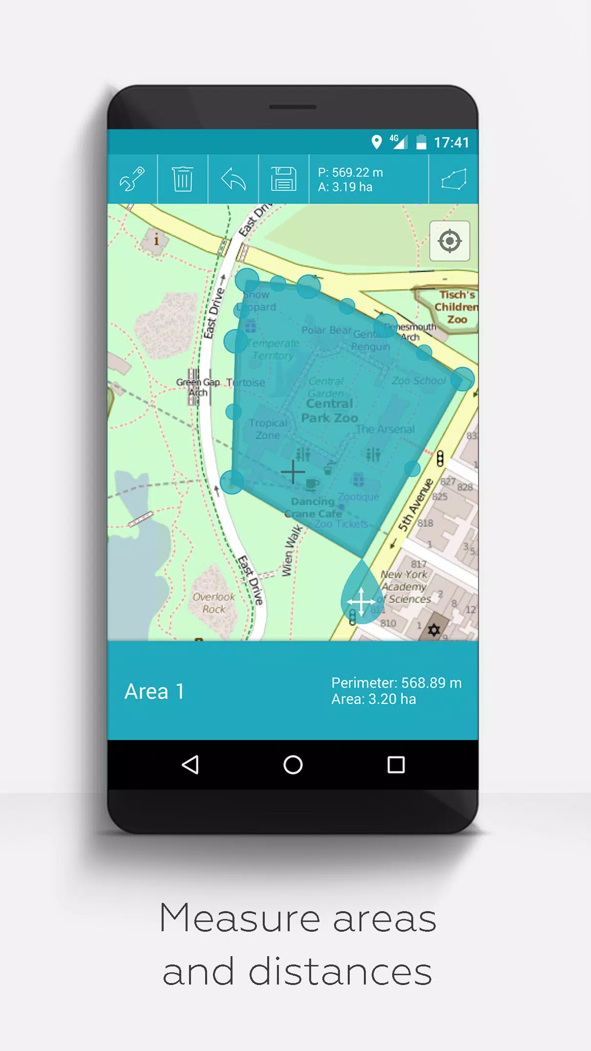
- Measure distances and areas on your map
- Multilingual support (currently English, Spanish, Lithuanian, Polish)
For those who wish to support our efforts, we offer extended features that can be activated in the app's settings through donations or by liking us on LinkedIn:
- Download maps for offline use (OpenStreetMap)
- GPX viewer (view GPX files only)
- Display arbitrary map data using Web Map Service (WMS), e.g., OpenData from www.data.gov
- Create custom metadata
- Upload and use custom icons
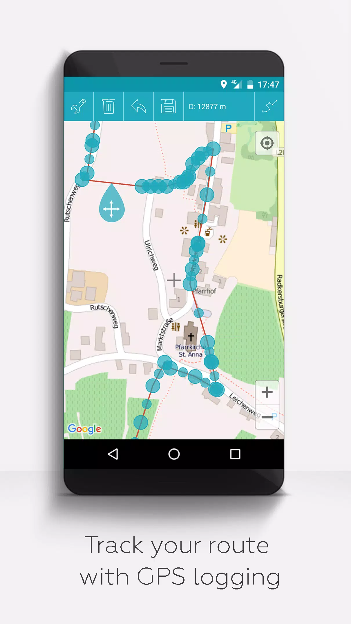
- Record GPS tracks
Unlike other apps, MAPinr respects your privacy and does not collect or sell your data. Your donations are a voluntary contribution to support our non-profit mission. Thank you for choosing MAPinr.