2GIS offers a comprehensive mapping and navigation solution designed for both drivers and pedestrians, combining offline map access with real-time GPS navigation, live traffic updates, parking information, public transit routes, and more. Whether you're exploring a new city or navigating your daily commute, 2GIS ensures you stay connected and informed—no internet connection required.
Explore the Full Range of 2GIS Features
- Offline Maps: Download maps directly to your device for seamless navigation anywhere, anytime—even without an internet connection.
- Precise Address Search: Locate exact addresses, company details, phone numbers, working hours, available services, and even specific building entrances.
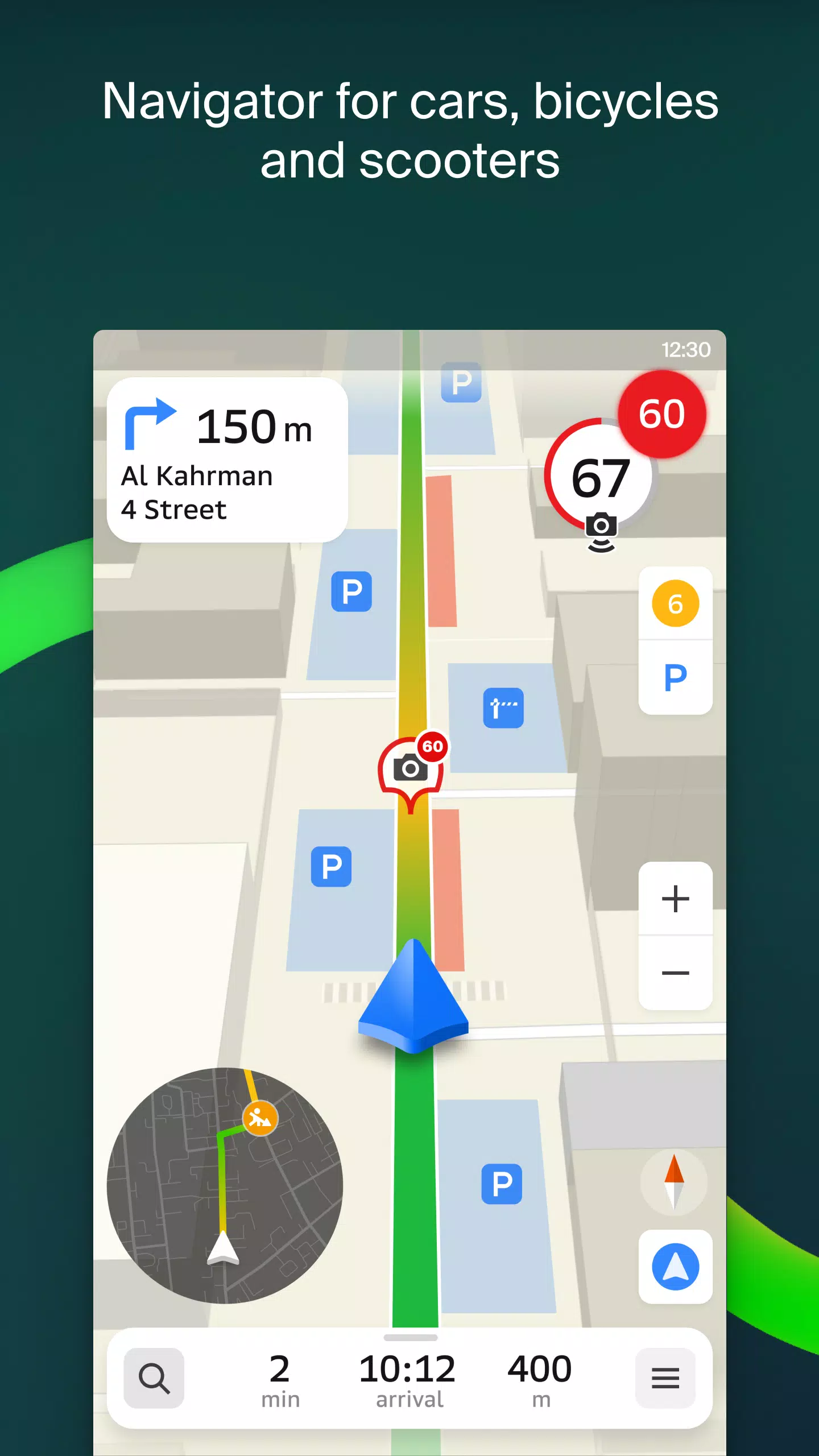
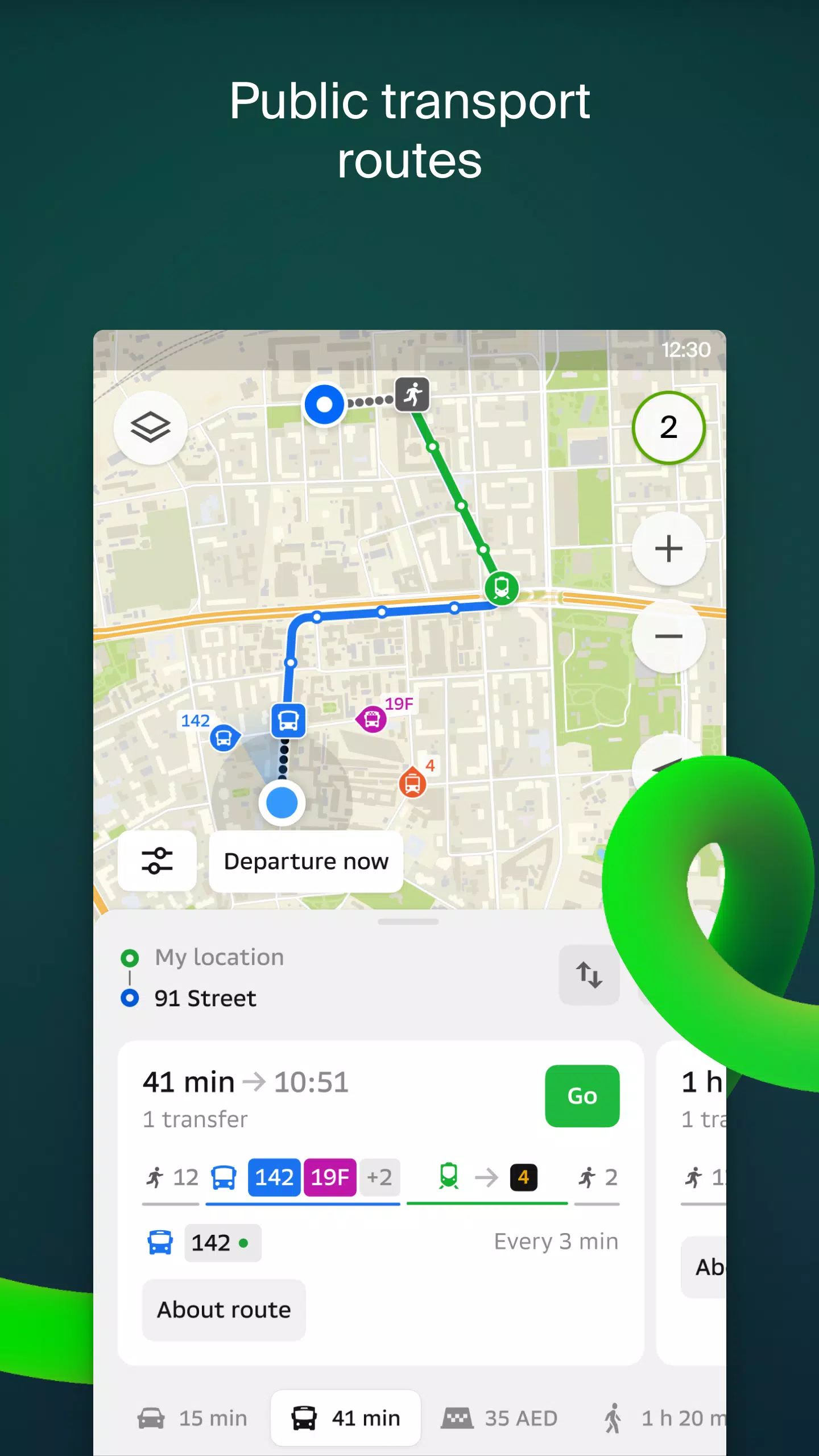
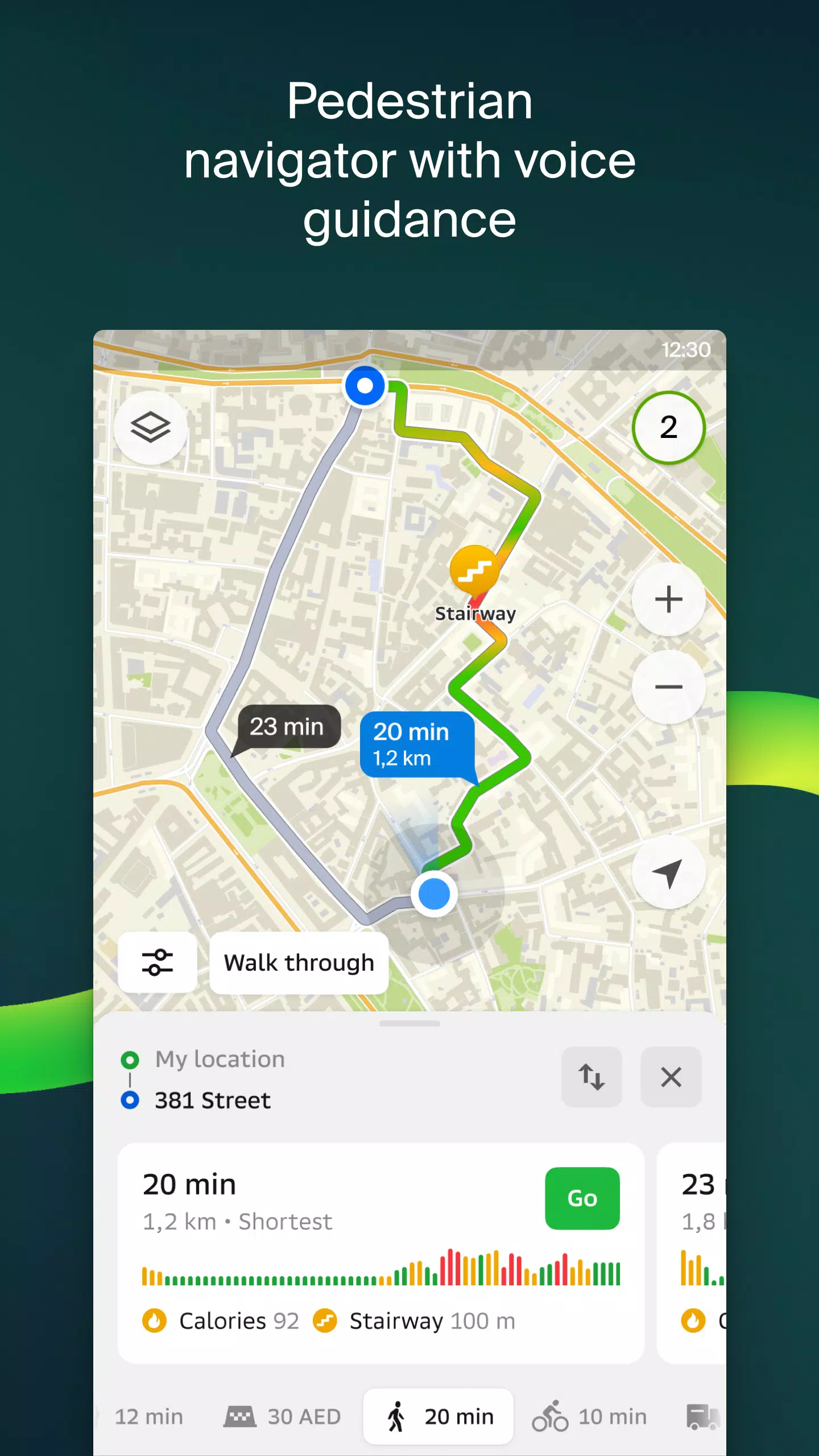
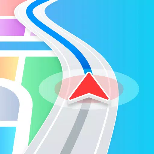
- Smart Routing: Plan your journey by car, bus, subway, or on foot using optimized routes that factor in real-time traffic, road signs, speed cameras, toll roads, and unpaved surfaces.
- Real-Time Traffic Updates: Avoid delays with live traffic data, including accident reports, road closures, and user-submitted notes directly on the map.
- Public Transport Integration: Access detailed transit schedules and live route tracking for buses, trams, metros, and other forms of public transportation.
- Pedestrian Navigation: Navigate on foot with voice-guided directions, background support, and turn-by-turn guidance tailored to walkable paths.
- Truck Navigation: Specialized routing for cargo vehicles, considering vehicle dimensions, weight limits, and transport regulations.
- Business Directory: Find verified business information including addresses, contact details, operating hours, websites, reviews, and photos uploaded by users.
- Travel Guide: Discover top attractions, free Wi-Fi spots, sports facilities, and other useful locations directly on the map.
- Safety & Location Sharing: Keep track of friends and family with real-time GPS location sharing, battery status updates, and private messaging with stickers.
- Smartwatch Compatibility: Enhance your mobility with the 2GIS Notifications app for Wear OS devices. View maps, receive maneuver alerts, and get vibration notifications while navigating on foot, by bike, or via public transport. Automatically syncs with your phone’s navigation session. Requires Wear OS 3.0 or later.
Available Cities
United Arab Emirates: Dubai, Sharjah, Abu Dhabi, Al Ain, Ajman, Ras Al Khaimah, Fujairah, Umm Al Quwain, Dibba Al Fujairah, Khor Fakkan, Kalba, Al Salamah, and more.
Russia: Moscow, Saint Petersburg, Novosibirsk, Ekaterinburg, Krasnoyarsk, Chelyabinsk, Ufa, Omsk, Kazan, Perm, Nizhny Novgorod, Sheregesh, and others.
Other Regions: Minsk (Belarus), Pavlodar, Semey, Aktau, Aktobe, Almaty, Nur-Sultan, Bishkek, Karaganda, Kokshetau, Kostanay, Osh (Kyrgyzstan), Baku (Azerbaijan), Tashkent ([yyxx]Uzbekistan[/yyxx]), and many more cities across Central Asia and Eastern Europe.
Get Support
For assistance or inquiries, reach out to the 2GIS team at [email protected]. Whether you need help with installation, features, or technical issues, their support team is ready to assist.